Radius Buffer
How to create a buffer radius from a dataset
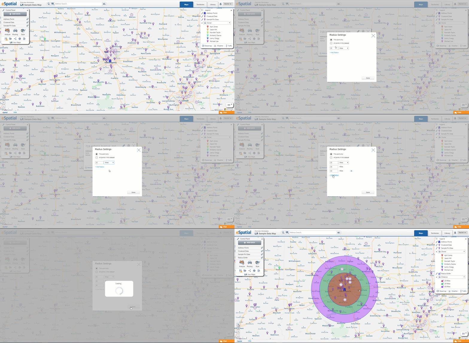
- Select the point you wish to add a radius buffer to.
- When the data window appears select the Tools option.
- Choose radius.
- The radius buffer window will then appear from here you can select the following:
- Select whether you want to create a radius buffer from just the select point or all the points in the selected dataset.
- Set your distance criteria such as miles, kilometers, feet etc.
- You can add up to 3 radius’ by selecting add radius
- Once all chosen radius distances are inputted select done.
- Your radius buffers will appear on your map
Note: Unlike a radius analysis this does not automatically filter your data to only that within the buffer to filter your data down see Filtering Data from Buffers and Regional Boundaries

