The following actions can be taken from the following eSpatial Boundaries
- Geographic Regions: Such as Countries, States, Counties.
- Territories: You can use the Sales Territories you have built in eSpatial.
- Drawn Polygon: You can use polygons you have created using the Draw Polygon Tool in eSpatial.
- Buffers: You can use Radius and Drive-Time Buffers.
Available Actions
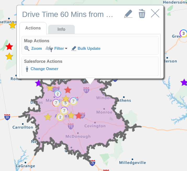
- Zoom: Re-centres and zooms the map into the polygon
- Filter: Filters out data both on the map and the table. e.g. Filter out all leads that are not within the selected State.
- Bulk Update: Bulk update records within the area. This is useful to update the states, or region of a record. In the first field, select the dataset you are looking to update. In the second field, select the attribute you are looking to update. In the third field select the value you want to update the values to in Salesforce. For Salesforce fields that are populated by a drop down list, the drop down list will also be available in eSpatial. Up to 1,000 records can be updated at once.
- Add to Campaign: Add leads and contacts within this Polygon to a Salesforce Campaign. Only recently accessed campaigns will be listed in the add to campaign dropdown. If the campaign you are looking for is not listed in the drop down, access Campaigns in Salesforce and open the campaign you want to add to. Then refresh eSpatial in Salesforce and try to add to campaigns again.
- Change Owner: Bulk Change the owner of Salesforce Records. This is a great way of reallocating leads and accounts based on location. After the realignment of Sales Territories in your organisation, you can use eSpatial to change the ownership of the records in Salesforce. Up to 1,000 records can be updated at once.