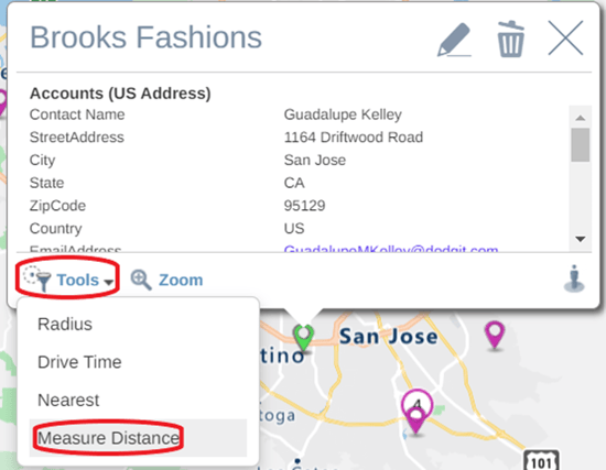
- Select the point you wish to measure from
- When the info pop up appears select the Tools option
- Choose Measure Distance
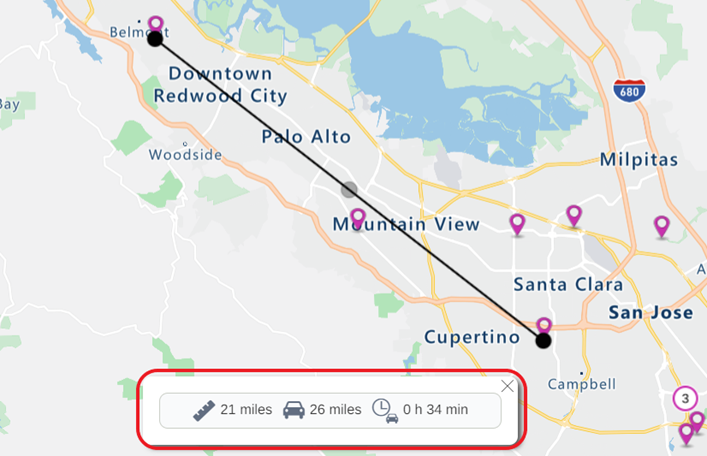
- The measure tool crosshair will then appear on the screen.
- Click anywhere on the map to measure the distance to that point. The distance pop up showing the straight-line distance in miles, the driving distance in miles, and the driving time will appear at the bottom of the screen.
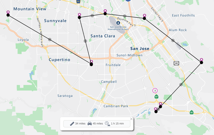
- You can continue clicking on your map to continue adding nodes to your measurement calculation or you can click on any of the nodes to drag and move to edit the measure line.
- You can also click on the starting point to close the polygon.
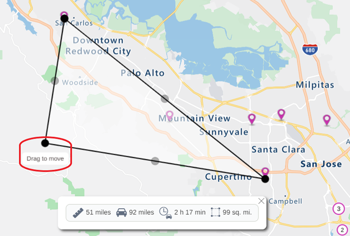
- To remove the measurement line/shape, click the X on the distance pop up.