-
Getting Started
-
Video Resources
-
Data (Preparing/Adding/Editing)
-
Radius, Drivetime and Measurement Tool
-
Heat Mapping and Summary Analysis Tool
-
Territory Manager
-
Style
-
Data Table
-
Filtering Data
-
Routing
-
Saving, Exporting and Sharing Maps
-
Deleting
-
Managing / Organizing your Maps (Library)
-
Single Sign-On (SSO)
-
CRM & Data Integrations
-
eSpatial Mobile
-
For Salesforce
-
eSpatial Frequently Asked Questions
-
eSpatial Troubleshooting
Exporting Your Data
Export your Data from your Map as a CSV file.
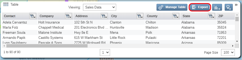
You can export the data from your map to CSV. This can be used to create a backup of your data especially when you have edited or added records within eSpatial.
- To export your data you must expand your table and select the export button
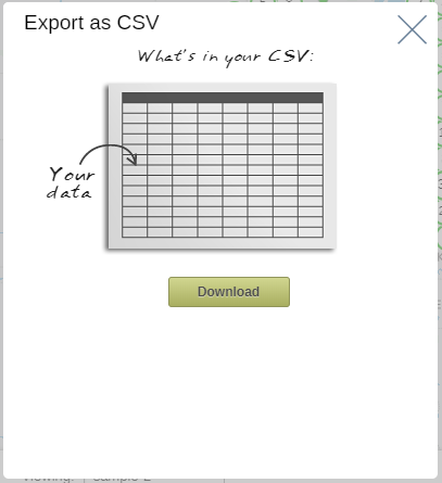
- A download window will then appear, select the download button and navigate to the folder you wish to export your data to.
Note: If you have your data filtered in your table only your filtered data will export.