
Workspace
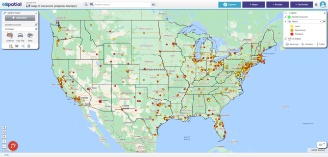
This is where you add, filter, style and analyze data. Within your workspace you can save one or more maps based on different configurations of data.
Control Panel
Here you can add data and analysis to your map, style your map and manage your locations.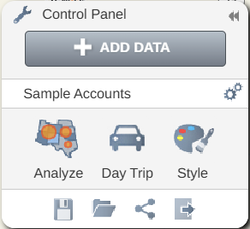
You can also:
- Save Map

- Open Map

- Share Map

- Export

Legend
The legend is where you can see what data is on your map.
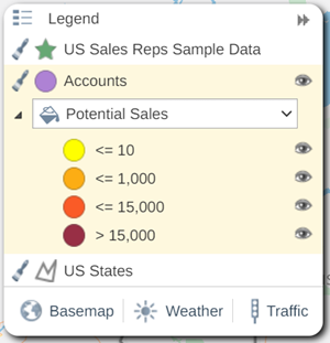
You can also:
- Switch on and off datasets by opening and closing the eye

- Switch on and off styling by clicking on the paintbrush

- Change basemap - click on Basemap and select a new basemap by clicking on one of the thumbnails
- Add Weather overlay – click on Weather and select Satellite or Radar to turn on
- Add Traffic overlay – click on Traffic to turn on or off
Map
A map is a saved view within a workspace. A map has at least one dataset, a default zoom scale, and basemap. Within your workspace you can save, edit and share multiple maps.
Table
This is where you can see the data you have added to your map and the results data from any analysis you have applied.
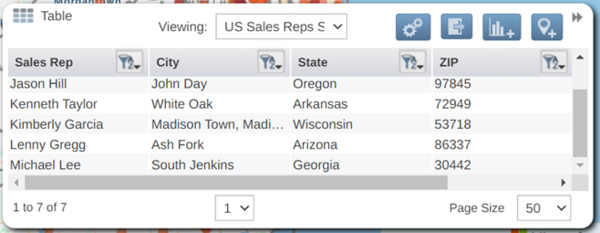
You can use the table to:
- Filter your data

- Add new data points

- Export the data

Navigation
You can use the navigation buttons in the bottom left of your map to navigate around the map.

You can use these to:
- Zoom to an area
- Show your Location
- Reset map tilt
- Zoom In
- Zoom Out
eSpatial Toolbar
This is the grey area across the top of eSpatial.

The Toolbar contains the following:
- Workspace / Map Name –You can rename your workspace and map here.
- Address Search
 –You can search for any address here. This will place an address point on the map.
 - Add Address point
 – Click on this and click on the map to place a point on your map. eSpatial will generate the address (where possible) for this location.
 - Add an annotation
 – Click on this and click on the map to place an annotation. An annotation is like a text box on your map where you can include links, images, text and more to help add context and additional information to your map.
 - Draw a polygon
 – Click on this and then click on the map to draw a custom area on your map. This is used to create your own boundary on a map or to filter out and update selected points from one of your datasets.
 - + Maps – Click this for our Mapping solution. You can create a new workspace or open an existing map. This section is used for your data visualization needs from simple pin mapping, heatmaps, coverage maps, radius and drive time maps and a whole lot more.
- + Routes – Click here for our Routing solution. From here you can create a new schedule or open an existing one.
- + Territories – Click this to use our Territory solution. You create and edit your territory alignments in this section of the product.
- Notifications
 – You will find notifications about shared maps and workspaces.
User Menu
The drop down menu in the top right of the toolbar 
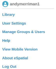
The User Menu contains:
- Library – Here you will find all the datasets that you have uploaded as well as those that have been shared with you. You will also find a huge selection of boundary datasets supplied by eSpatial. All of these can be used to create compelling maps.
- User Settings – Here you can see what usage limits you have regarding Datasets, Maps, and Geocodes in your account and how much you have used. Your own account details including name, email and account type will also be displayed. You can also change your password here.
- Manage Groups & Users – If you have a multi user account you can manage accounts, users, and privileges here.
- Help – This links to the help section.( https://help.espatial.com/)
- About eSpatial – This is the About eSpatial window. This contains information about the current eSpatial release version.
- Log Out – Here you can log out from your session.
Notifications
When a Workspace, Map or Dataset is shared with you and there are any changes made you will get notifications in the Top Toolbar. The Notifications bell will turn blue when you have a new notification. You will get notifications when one of the following events happen:
- A Workspace, Map, territory or Dataset is shared with you.
- If there are any updates to a shared Workspace, Map, territory or Dataset
Chat
If you have any questions, you can contact us using our in-app chat on the bottom left-hand side of your screen.
