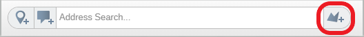
The Draw Polygon button can be found in the Top Toolbar beside the Address Search box. You can use Polygons to interact with the other data on your map. For example, you can add a polygon and run a filter search for points from your other datasets that fall within the polygon.
You can draw a polygon on the map which will create a new dataset, available only on map they are on, called Custom Areas. This will be displayed in the Legend and the Control Panel as normal and can be styled but will not be listed in the Library.
Drawing a Custom Area/Polygon
- Click on the Draw a Polygon button and click on the Map where you would like to start.
- Hold down the left button on your mouse and draw the shape of the area that that you require. If you prefer, you can also left click on the map to create waypoints in the polygon until you have drawn the area and shape you require.
To pan your map while creating your custom areas, you can move your map using the up, down, left or right arrows on your keyboard.
- Click on the Confirm button to accept the shape and area you have drawn.
- Click on the Cancel button to cancel the drawing.
- Click on the Custom Areas dataset in the Control Panel and then click on the Trashcan icon to remove it from the map.

Filtering Datasets using a Custom Area/Polygon
- Click on a drawn polygon and select Filter from the Information window.
- This will apply a filter to the Map and Table and only include any points contained within the Polygon

Renaming a Custom Area/Polygon
You can edit the name of the Polygon.
- Click on the polygon to open the Info window.
- Click on the Pencil icon to enable editing.
- Edit the name of the Custom Area and click on the Save icon.
